The MAESTRALE project is funded within the framework of Priority Axis n. 1 of Interreg MED 2014-2020 Programme, with eight participating countries and a Greek partner of the School of Architecture of the Aristotle University of Thessaloniki. Participants in the program work together to identify prospects for the development of blue energy in the Mediterranean, taking into account the natural, legal, technological, economic and social context.
The specific objectives of the program include the elaboration of a techno-economic assessment for two blue energy pilot projects. In order both to select the appropriate technologies and to identify possible locations for the siting of the pilot projects, the AUTH MAESTRALE team used geospatial data of the webgis platform created for the needs of the program.
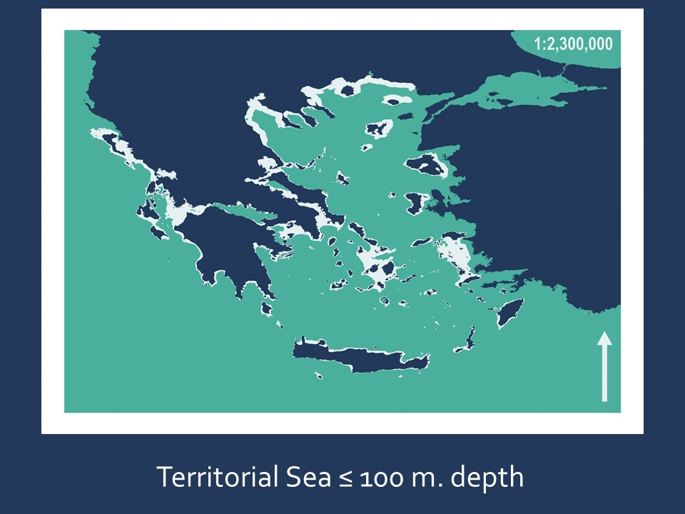
The methodology implemented for this preliminary study is as follows: The areas with a depth of more than 100 meters, where current technological constraints do not allow the installation of blue power plants, were removed from the Greek territorial sea. All marine areas protected at national, European and international were also removed. The overlay of the remaining areas with the data on wind wave and marine currents energy potential resulted in the production of three maps / levels where the blue energy potential of the country in areas where the siting of the pilot projects is both technologically feasible and potentially permitted (after taking into consideration other local and case-specific factors, such as landscape protection, other economic activities, etc.).
![]()